TL;DR
- A licensed pilot who knows local airspace matters here. Chesapeake sits close to Norfolk Naval Station and NAS Oceana, so a lot of the city falls under controlled airspace that requires FAA authorization before a drone leaves the ground.
- The city is not one place. Farmland near Hickory, new subdivisions in Greenbrier, and waterfront homes along the Elizabeth River each call for a different flight plan and a different camera.
- After a nor’easter, a drone can put eyes on a roof in twenty minutes without anyone climbing a wet ladder. That single use case pays for the flight on most jobs.
- Listings with aerial photos tend to draw more clicks online, which is why so many agents in Hampton Roads now budget for a short flight before a property hits the market.
- Hobby footage and survey-grade data are not the same thing. Orthomosaic maps, volume measurements, and 3D models come from calibrated workflows, not a weekend quadcopter.
- Weather off the water is the real schedule-killer in coastal Virginia. Wind, salt air, and pop-up summer storms decide more of our calendar than anything else.
Why do Chesapeake businesses and homeowners need a professional drone service?
A few years ago, I was asked to photograph a property of five acres located near Hickory. The owner was trying to sell the property for a long time using phone photos that were taken from the drive. The issue was that the most beautiful part of the property was a creek that drained through the back of the lot, with an old hardwood stand surrounding it, which was largely unnoticed by the public. Anyone buying online could not know what they were buying.
One flight changed everything. From 200 feet, the water, the tree line, and the way the property was positioned against its neighbors were all seen in one frame. The listing was put under contract just a few weeks after. The land was not altered. People could see it had changed.
This is the short version of the reasons why a drone is worth the effort. Here at Virginia Drone Solutions, most of our work boils down to one concept: obtaining high-quality, precise information from a position that was previously an aircraft, a bucket truck, or a long and dangerous ladder.
The view from above answers questions the ground cannot
In a parking lot, you can see the condition of an unflat commercial roof. You can’t actually see it. You can estimate the distance a new road is situated from a buffer wetland. It’s impossible to determine it. Aerial imagery transforms your assumptions into something you are able to show and share with others, and act upon.
This is crucial when a homeowner is deciding if the damage from a storm warrants an insurance claim, or for a developer in Greenbrier showing a lender where the building is, as well as the city department that is monitoring the condition of a culvert that most people do not even look at. These are all different questions. The reason behind why you are climbing is exactly the same.
Faster answers, lower risk, real records
Speed is a factor. A roof that would take a professional half a day to inspect using a ladder could be inspected, flown, photographed, and recorded in just one hour. Safety is also a consideration. No one is climbing anything. And the video and stills are a record that you can refer back to later, which gives it an added benefit when a dispute or claim arises six months later.
What do drone services in Chesapeake actually cover?
People tend to picture pretty videos when they hear “Drone Services in Chesapeake.” That is part of the job, and we love that part. But the bulk of professional aerial work in Hampton Roads is practical, and it splits into a handful of categories.
Here is the range of work our team handles around the city:
- Real estate and property marketing: stills and video for homes, land, and commercial listings, plus interior-to-exterior reveal shots
- Roof and structure inspections: close-range imagery of shingles, flashing, gutters, chimneys, and flat commercial roofing
- Construction progress and site documentation: recurring flights that track a build from grading to certificate of occupancy
- Mapping and surveying support: orthomosaic maps, elevation models, and stockpile volume measurements
- Infrastructure and asset surveys: bridges, towers, solar arrays, retention ponds, and utility corridors
- Creative and event work: promotional reels, aerial b-roll, and coverage for community events.
Real estate aerial photography that sells homes
Aerial photos accomplish two things for listings. They give buyers a sense of perspective that a photograph from the ground can’t provide, such as lot size and water access, as well as how the property is positioned in relation to the surroundings. They also make a property stand out among the sea of phone snaps.
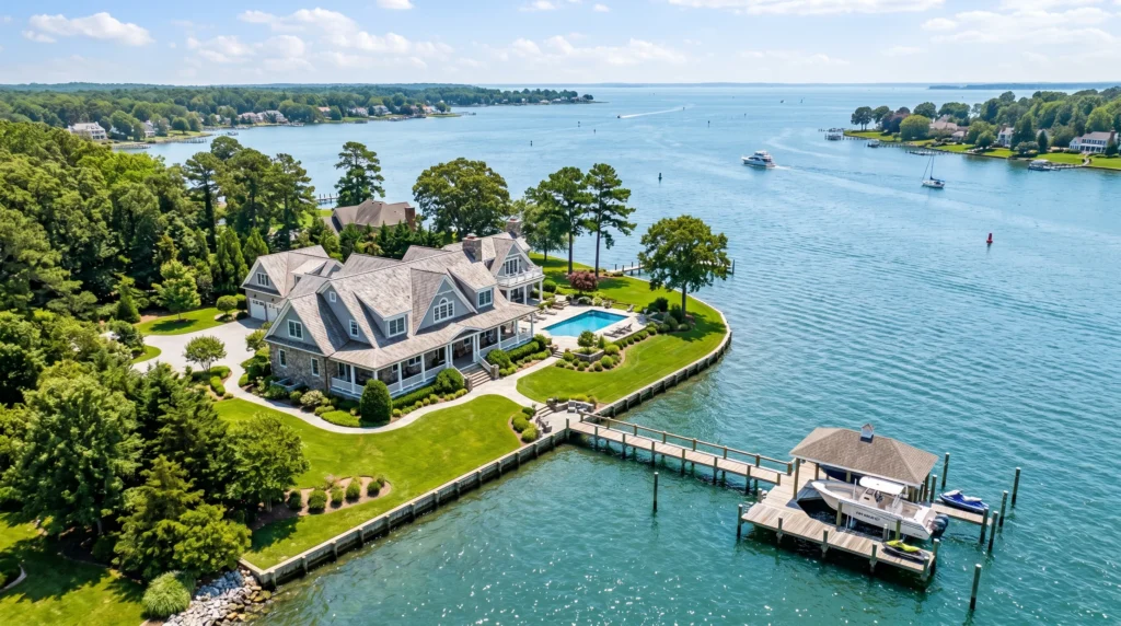
This is particularly relevant to listings that define the majority of Chesapeake homes that have acreage or properties that are located along the Intracoastal Waterway, and anything where the connection to the water is the primary selling feature. A view from the dock will tell you a little. A picture of the dock, the channel, and the way out to the open waters will tell the complete story.
“I had a waterfront listing in Great Bridge that had been sitting for weeks. We got fresh aerials done on a Tuesday, had them in the MLS by Wednesday, and had three showings booked by the weekend. The seller actually called to thank me for the photos. That’s never happened before.”
— Danielle R., real estate agent, Chesapeake
Roof inspections after coastal storms
The coast of Virginia gets a hammering from nor’easters and occasionally a tropical system. After a blow that’s not so good, homeowners and roofers are eager to know what transpired on top before the cost and time become a problem.
Yes, a drone can check your roof for damage from storms and is often the best first step. It is possible to fly near enough to see the displaced flashing, raised shingles, and impact marks, and then give clear images that you can send straight to an adjuster or contractor. Roofs that are steep, slick, and tall, such as those of commercial buildings, are precisely where this method makes a profit, as no one has to take a fall to get the answer.
Mapping, surveying, and orthomosaic data
This is the job that the majority of people don’t know what drones perform. By flying a grid and stitching hundreds of interspersed photographs together, we create an orthomosaic, which is a single distortion-corrected image that you can use to take measurements from. Add elevation data, and you’ll have volume models and contour models.
Developers employ it to confirm earthwork. Solar and landscape companies make use of it for planning. The key point is that it is data, not a piece of art, and must be captured with the correct overlap, the proper altitude, and proper ground control to be reliable. This is the part of the area where amateur efforts usually fail.
How does Chesapeake’s geography change the way we fly?
Chesapeake is among the biggest cities in terms of area in Virginia, and it doesn’t appear to be one when you fly through it. The southern portion of the city is the Great Dismal Swamp. The middle area is populated by suburban areas. The waterfront is pushed into Norfolk and Portsmouth. Each one requires an alternative approach.
Farmland and rural parcels near Deep Creek and Hickory
In the direction of Deep Creek and Hickory, you’ll find working farmland and vast rural areas. These jobs are mostly agricultural and land-focused, such as monitoring of fields and crops, drainage and erosion check, and acreage-related marketing of properties that are difficult to capture in any other way. The airspace is typically more accessible here, but the coverage of cell phones and launch logistics requires more planning.
New developments in Greenbrier and the suburban core
Greenbrier and the suburbs are where commercial and construction work is concentrated. New subdivisions, retail pads, and office spaces are popping up, and frequent documentation flights are regular. The issue here is density rising: more rooftops, higher density of cars, more people, and stricter regulations regarding flying over people who aren’t an integral part of the business.
Waterfront along the Elizabeth River and the Intracoastal
The water is the main focus and the complication. Property on the Elizabeth River, the Intracoastal Waterway, as well as the Dismal Swamp Canal, photographs beautifully from the air. They are also located in more congested airspaces that are more sensitive, and salt-laden winds coming from the water can affect the stability of the aircraft and the longevity of the equipment. We plan water projects around wind direction and not the reverse.
What kind of weather is unsafe for drone flight?
This is the question that governs the calendar of our state more than any other. The truth for the coastal region of Virginia is that the weather influences our calendars more frequently than the regulations do.
Conditions we will not fly in include:
- Sustained winds or gusts beyond the aircraft’s rated limit, which is common when fronts move through
- Active rain, since most camera drones are not built to get wet
- Fog or low visibility that breaks the line-of-sight rule pilots are required to maintain
- Lightning anywhere in the area, including the fast summer thunderstorms that build over the swamp
- Temperatures cold enough to sap battery performance, which shortens safe flight time
If conditions look marginal, we would rather reschedule than risk an aircraft or, worse, a bad outcome on the ground. A clear morning is usually our friend here; the air tends to be calmest before the afternoon heating kicks up the wind.
Can you legally fly a drone near a military base in Chesapeake?
Short answer: sometimes, with the right authorization, and often not at all in the most sensitive spots. This is the single most important reason to work with someone who actually knows the local map.
Chesapeake is situated in some of the most controlled airspaces on the East Coast. Norfolk Naval Station sits just to the north. NAS Oceana is next door in Virginia Beach. There is a lot of traffic coming through and out of Norfolk International, and Chesapeake Regional Airport handles general aviation in the vicinity. Additionally, the Great Dismal Swamp National Wildlife Refuge has its own set of restrictions regarding drone landings and takeoffs, which have nothing to do with the FAA.
LAANC and controlled airspace, in plain terms
A large portion of Chesapeake is located in controlled airspace that is tied to these facilities. The legality of flying drones in these areas requires a permit, and for licensed operators, this is typically done through LAANC, the FAA’s system of requesting approval, usually within minutes in areas that are approved. Certain zones allow fast approval for up to a certain altitude. Others require a manual application that could take days. There are a few areas where you can’t fly without special arrangements.
A hobbyist application can’t accurately identify the category you’re in. A mistake made near a military facility isn’t a matter of paperwork. It’s the kind of error that draws attention from the federal government. Being aware of where the boundaries lie across Great Bridge, South Norfolk, and rural South Norfolk is a crucial aspect of the job, not a mere footnote.
Restricted zones and the Dismal Swamp
The Great Dismal Swamp is worth making a statement for its own sake. As it is a National Wildlife Refuge, it generally prohibits the launching or landing of drones within its boundaries, regardless of airspace classification, so as to ensure the safety of wildlife. We have plans to circumvent it. The main point is that “legal to fly here” is contingent on layers of rules, and a professional from Hampton Roads keeps all of the layers in order prior to giving a quote.
What UAV services are available for commercial clients in Chesapeake?
Commercial work forms the core of what we do, and it’s a habit to repeat the same location and timetable and accumulate records over time. For companies, there is more value in a single striking image and more in consistent, comparable data that they can create plans around.
Construction site progress monitoring with drones
Commercial drones in Chesapeake are able to earn their place on the job site by replacing the slow, ground-bound report with a clear weekly report. We fly the exact flight path at a certain interval, which means that each sequence of images aligns with the previous. Project managers can scroll through the build, examine the actual and planned progress, and share a reliable update with lenders and owners without requiring anyone to visit the website.
“We were running a build out in Greenbrier on a tight timeline. Having drone flights every couple of weeks meant I could send the owners a real picture instead of a status email nobody trusted. It caught a grading issue early too, which probably saved us a week. Money well spent.”
— Marcus T., construction project manager, Hampton Roads
Inspections for roofing, utilities, and infrastructure
Companies that build roofing employ UAV services in Chesapeake to assess the job and record conditions before and after, which can help protect them in case of disputes. Facilities and utility teams utilize aerial imagery to check solar arrays, towers, retention ponds, and other difficult-to-access structures without shutting down or placing a worker in danger of falling. Local government officials as well as larger property owners rely upon the same aircraft for asset surveys, obtaining an accurate and reliable record of their property and the condition it’s in. The same pattern can be seen for all of them. See more, climb less, and keep records.
What does it cost, and what can you expect from our team?
The first question almost everyone asks is price, so let me be straight about it.
How much do drone services cost for a real estate shoot?
A typical residential real estate shoot is typically the cheapest thing we can offer, typically an all-inclusive package that includes an agreed-upon number of edited stills and a short clip. Commercial listings, larger homes, and twilight shoots are priced more because they require more time on the site and more time editing. Mapping surveys, mapping, and recurring construction flights are priced based on the size of the site, as the size of a one-acre site and a forty-acre site are not the same thing.
Instead of giving an estimate that isn’t appropriate for your needs, we offer no-cost consultations as well as a detailed written estimate prior to signing. There are no surprises on your invoice.
What you’re actually paying for
This is where the difference between a hobbyist and a professional shows up. When you hire our team, you are paying for:
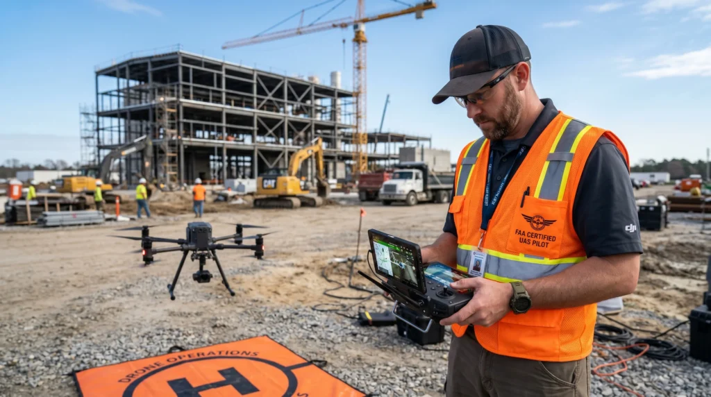
- A pilot who is fully FAA Part 107 certified and current
- Full liability insurance, with a certificate available on request before we ever fly your job
- Years of flying experience specifically across Chesapeake and the wider Hampton Roads region
- Real knowledge of local controlled airspace and the authorizations each area requires
- Professional-grade aircraft and cameras capable of high-resolution stills, 4K video, and 3D mapping
- Edited, ready-to-use deliverables, not a memory card of raw clips
We also respond quickly. For most shoots, we can provide same-day or next-day turnaround of the aerial data, since in the construction and real estate industries, a wait of a week can be a deterrent to a sale. As a locally owned and operated business, Virginia Drone Solutions treats the need for a quick, honest turnaround as the norm and not as an extra.
Should you hire a pro, or can you do it yourself?
Drones are less expensive and easier to pilot than they’ve ever been before, so it’s a good question. If you’re looking for a backyard activity, such as a sunset view over your backyard or an entertaining video of your kids playing in the pool, drones for consumers are great. Enjoy it.
However, when marketing, money, legal liability, and tangible data are added to the equation, the calculation is altered. Here’s the truthful breakdown.
Where DIY runs into trouble
Three factors can make it difficult to follow the DIY method. First, there’s the law that flying for any commercial purpose requires a Part 107 certificate, and flying in the airspace controlled by Chesapeake requires a permit that many people aren’t aware of how to obtain. The second issue is risk when something goes wrong on the property of a customer or in a public area; the uninsured person is personally liable. The third result is of the incident. Clean, properly exposed footage of real estate comes from the technique and editing, not only an excellent camera.
Why a professional drone in Chesapeake is worth it
A professional handles the authorizations, takes care of insurance, and provides an end product, not raw clips. A local pilot already knows the peculiarities of this region, such as where the airspace boundary lines fall, how the wind blows in the vicinity of the river, and the best time to illuminate the property’s waterfront. This knowledge is difficult to obtain and is impossible to download.
If your plan involves selling a house or a building, or filing a claim, or making a final decision based on the images, hiring out is nearly always the best choice.
Ready to get a clear picture from above?
If you’re looking for a home or a project or a problem that you think would be more easily solved from a distance of 200 feet, and that’s precisely the kind of thing we’re here to help with. Virginia Drone Solutions offers free consultations to homeowners, agents, and contractors in Chesapeake as well as the nearby Hampton Roads cities, including Virginia Beach, Norfolk, Portsmouth, and Suffolk. Let us know what you’re looking to observe, and we’ll inform you with certainty whether drones are the right tool for you and what will be required to operate them legally and safely.
Reach out for a free quote, and let’s get your project in the air.
Conclusion
A drone is a tool, not a magic trick. What makes it worth the call is rarely the drone itself. It’s having someone who knows which parts of this city sit under controlled airspace, how the wind comes off the river on a fall afternoon, and the difference between footage that looks nice and data you can actually make a decision on.
Whether you’re a realtor trying to get a Great Bridge listing noticed, a contractor documenting a Greenbrier build, or a homeowner who just wants to know what a nor’easter did to the roof, the answer is usually clearer from above. The trick is getting that view legally, safely, and in a form you can use the same day.
If you’ve got a property or a project that would make more sense from 200 feet up, ask for a free consultation. Worst case, we tell you honestly that a drone isn’t the right tool for the job. Best case, we hand you the picture you’ve been missing.